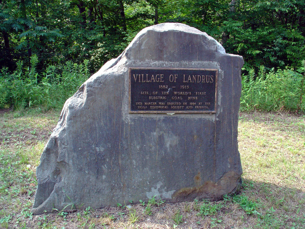
 This is the Landrus marker/sign that most people may be familiar with. It is located right next to the Landrus road, on the Babb Creek side. There is a bit of a crossroads here, one heading down towards the creek, and the other up towards the foundations and the small creek here that i build my sculptures on (Bear run i believe it may be called, i don't think i've ever seen a name for it on any map).
Friday, July 22, 2005
the info signs at Landrus, pt. 2
Saturday, July 16, 2005
Abutments & mossy waterfalls...part 2
 ...these are the other two abutments i was speaking of, which are west of landrus. The westernmost one (top photo) is pretty much surrounded by the creek, though there is rock outcrop on the north edge that is almost like stairs. The water on this side is very deep where the creek has cut
 away all the way down to the bedrock and up against this abutment. Ben was bouldering on this, confident that if he did happen to fall, the water was deep enough that it would break his fall. The Mid State Trail will come to this abutment and follow the old rail grade that goes west from here 'til Nickle Run.
The abutment on the other side, the east side (bottom photo) is in just as good of shape. It has definitely taken some water throughout the years - behind the sagging rocks on the left side, the grade has been eaten away through floods, but, the damage is only minor, i assume, compared to the amount of water going over it, and time this has been going on. This grade looks so odd, looking at it from the abutment on the other side...there is this beautiful creek bed and then this man-made monsterous raised grade just sitting there, in the middle of nowhere. I'm glad to see that it's still there tho. Many of the old grades in the Landrus area had been removed during construction of the area's mine reclamation projects. I wonder now if there are more bridges on the main grade that i don't know about.....
Tuesday, July 12, 2005
Flood sculptures & doomed tadpoles


The tadpoles were in this shallow pocket on the sunbathing rock on Babb Creek at Landrus. They couldn't have been there long, cos we'd only had so much rain and the time before when i was there (2 weeks perhaps) there was no water in those pockets. So, we used an empty bottle to add some fresh water to the pockets from the creek, possibly giving those little guys a chance.
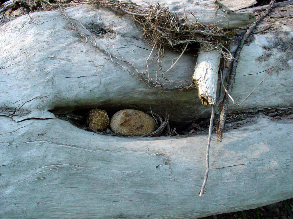
The "sculptures" were a log i found upstream from the big rock. It had a bunch of flood debris caught up in it, but there was this little pocket with the two stones that i just loved. The composition of the whole thing turned out nice. Thanks nature. To see some more photos of this go to http://pictures.insanart.com/landrus. There are a whole bunch of these types of things on the creek right around Landrus that i need to photograph.
the info signs at Landrus, pt. 1
LANDRUS 1880 - 1914 Home of the first electrified mine in the world and in it's heyday, it had: 1 company store, 1 post office, 1 school, 2 churches, 1 sawmill and 62 homes. Peaked in 1899.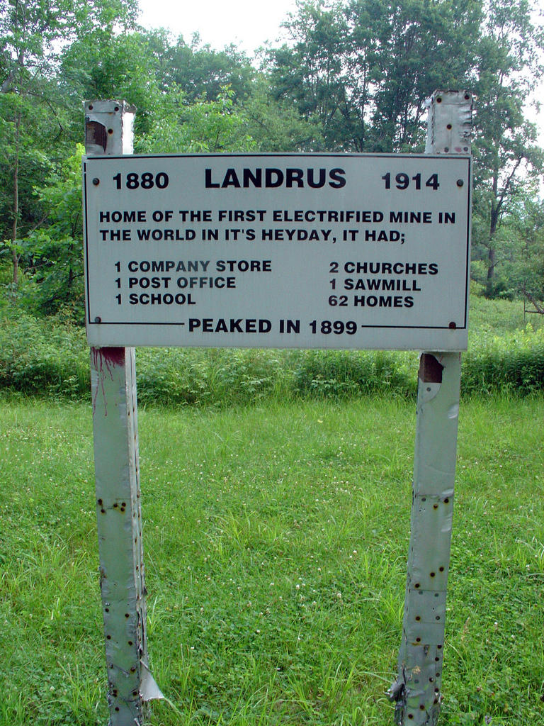
This is one of three signs/monuments located at Landrus. This one is located just east of the main Landrus monument, on Landrus Rd., and is fairly visible from the road because the grass is maintained here. It reads:
Friday, July 08, 2005
Abutments & mossy waterfalls...part 1

I came across these the day i sort of stumbled upon the proposed Mid State Trail for the first time.
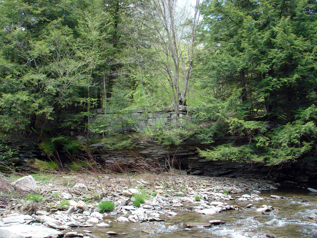
Not too far east of Landrus is this great old pair of railroad bridge abutments on either side of Babb creek (the one on the northern side is shown in the bottom picture, above).
I had been following these mysterious flags (which i now know are *MST) on an old grade following the
north side of Babb Creek to the west. It was starting to get hard to follow the flags so i took a grade that cut off at a diagonal down closer to the creek.
The grade stopped, very cleanly, at the edge of the creek. There was a clearly manmade edge here and i could see where the grade continued on the other side, though at the time, the abutment there was obscured from my view.
I bushwacked my way west of the bridge a bit to find a way down to the creek, as the bridge is quite high. I carefully made my way thru the mossy bog above the *milky white waterfall (above, top) which is just a few feet west of the bridge.
The waterfall is kind of hard to see, especially this time of year, because it is situated in between the current north bank of Babb Creek and a long island, which is jungle-like, to put it nicely.
The abutments here are 2 of 4 that i have currently seen on Babb Creek. This one is not connected directly to the MST (very close though). The other 2 abutments are right on the trail, between Landrus and the outlet of Nickel Run into Babb Creek.
(*notes on the side: MST = Mid State Trail...also...What's up with that milky waterfall? I don't know...mine waste related i presume. The little creekbed above the falls is stained like that as well and the pool at the bottom of the falls has a white powder-like coating - many of the drainages on this hillside look like this...and there are MANY drainages!)
(UPDATE 10/4/05 - We explored the ridge directly above/north of the milky waterfall...two main drainages and countless springs are up there......the two main drainages come right out of the Bear Run Mine treatment ponds - the exhaust pipe at the head of the drains REAKED of sulphur....)
Subscribe to:
Posts (Atom)